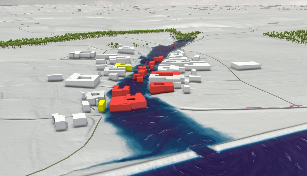
… for the preparation of special disaster control plans for floods in the Waldviertel region
Twenty-four municipalities along the Lower Austrian Thaya joined forces in this multi-year project to identify all regional flood zones and specific protection possibilities over a total area of more than 2,600 square kilometers with the help of the VRVis hydrodynamic modeling software Visdom and the water management expertise of Riocom.
More information can be found at the following link.